GPS Recording · On the Trail
Record new trails with your phone.
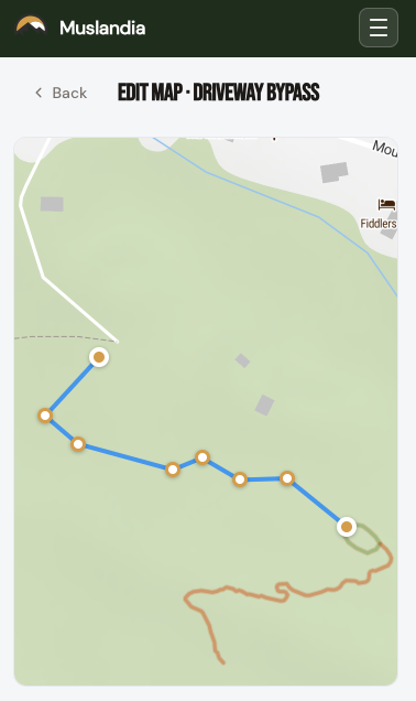
Record a new trail on the ground with your phone. Upload with one tap. Edit the geometry on your website’s map — drag vertices to smooth a wobble, or snap endpoints onto the existing network so junctions stay topologically clean. No desktop GIS software. No exporting. No “send me the GPX and I’ll deal with it later.”
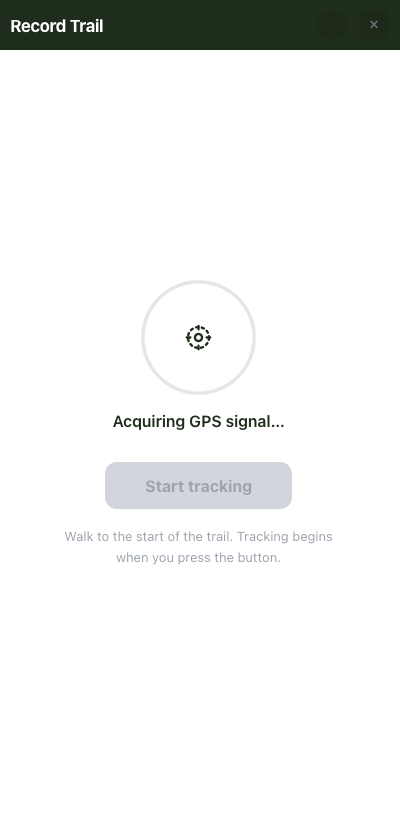
- One-tap field recording Any crew member with the field app becomes a trail surveyor. Hit Record, walk the line, hit Stop, upload. That’s it. Works offline; syncs the moment you’re back in range.
- High-accuracy GPS captureThe recorder uses the device’s best available GPS fix, filters out stationary noise, and keeps only the points you actually walked. What you upload is a clean track, not a jittery mess you’d have to manually scrub.
- Edit on your phone screenDrag any vertex to smooth curves or fix a bad reading. No round-trip to a desktop GIS tool, no emailing GPX files around the office.
- Snap to the existing networkOne click aligns the start and end of your new trail with the trails already on the map. Junctions stay topologically sound, routing stays correct, and your trail count goes up by exactly one — not by one-and-a-bit because of a floating disconnected endpoint.
- Publish when you’re happySave, and the new trail is live for visitors immediately. No build, no deploy, no pipeline — just a new line on your public map that your crew walked into existence an hour ago.
STOP RUNNING YOUR TRAILS OUT OF A SPREADSHEET
Give your trail organization the tools to communicate better, work smarter, and prove their impact.
No credit card required · Free forever plan available