It takes about thirty seconds
Open the app, confirm the trail, pick what you found, photograph it, send. Shorter than the message you were going to post about it.
See it. Snap it. Send it.
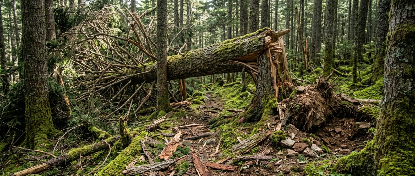
Spot a downed tree, a washout or a damaged sign? Pull out your phone, tag it where you are standing, and the people who look after that trail know about it before you are back at the car — with your photo and the exact spot attached. This is how good trails stay good.
Why bother
Most trail organizations are a handful of people, often volunteers, looking after more miles than they can walk in a season. You were out there today. They were not. Every report you send is a mile they did not have to drive, and a problem they get to fix while it is still small.
Open the app, confirm the trail, pick what you found, photograph it, send. Shorter than the message you were going to post about it.
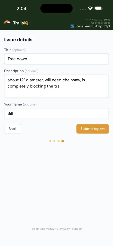
Anonymous by default — no password, nothing to remember, nothing to unsubscribe from. Add your name if you want the crew to know who spotted it. Skip it and the report counts exactly the same.
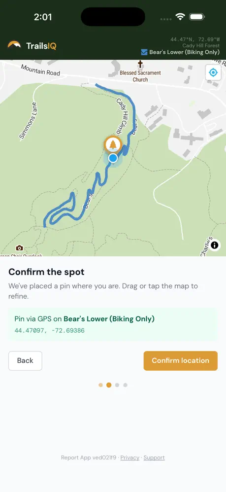
GPS picks the trail you are on and attaches the exact position, so nobody has to interpret "past the second switchback".
One picture settles what a paragraph cannot: how big, how urgent, and whether it needs a saw or a machine.
You do not need to know who manages the ground. The report routes to whoever maintains that trail.
Optional: follow an organization and get a push when a trail condition changes or their daily report goes up.
What happens next
It is not an email somebody has to read and retype. It arrives as a real maintenance item, on the right trail, at the right spot, in the same system their crew works from every weekend.
The moment you send
No inbox, no comment thread, nothing for anybody to copy out by hand. Your report shows up as a maintenance item on the right trail — photo attached, position pinned, the urgency you picked already on it. Everyone who runs that trail is told the moment it lands.

And you are not the only one
Roll up to that same downed tree twenty minutes later and the app already knows about it. Your report is on that spot for everybody behind you from the second you send it — so nobody files it twice, and nobody comes round that corner at speed with no warning. You are not just telling the crew. You are telling the trail.

What is worth reporting
A duplicate costs somebody ten seconds to wave off. A hazard nobody reported can cost a trail its access. If it made you slow down, stop, or step around, it is worth thirty seconds — and it is a lot more fun than posting about it and hoping the right person scrolls past.

How it goes
No account, no forms, no working out who to email. Thirty seconds on the trail and you are done.
The trail you are on loads from GPS. Change it if it picked a neighbor.
Blowdown, drainage, erosion, signage, a broken structure, a hazard — from a list.
One picture and one sentence. That is genuinely enough.
It goes to whoever maintains that trail, with your position attached.
TrailsIQ Report is free on iOS and Android and works on any trail system running TrailsIQ. Put it on your phone before your next ride and the next thing you find takes thirty seconds instead of nagging at you all the way home.