
Trails and networks
Import what you already have — GPX, KML or GeoJSON, in bulk — then group trails into networks and give each one its own difficulty, surface, direction and season.
Trails and networksTrailsIQ runs the whole life of a trail — from the first site visit to years of upkeep. For trail builders and the organizations that run trails. Maintenance, live conditions, your crew in the field, and the public pages your visitors read.
Free plan: 10 trails, 3 field workers, no card.
Download the free app


Most teams run their trails across a spreadsheet, a group chat, a folder of GPX files and somebody's memory. TrailsIQ is one system for the whole of it: what you have, what condition it is in, what needs doing, who did it, and what the public is told.
Free, no card. Answer one question about what your team does and the workspace turns on the sections you need and hides the rest.
Drop in GPX, KML or GeoJSON — a whole folder at once. Names, geometry and elevation come across together.
Group trails into networks, set difficulty and surface, and mark the infrastructure and points of interest that go with them.
Your crew installs the field app, downloads the network, and files what they find with or without signal.
Core features
Modules covering trail conditions, maintenance, infrastructure, planning, crews and your public site. A workspace shows the ones its team switched on and hides the rest, so the menu stays the size of the job.
Import what you already have — GPX, KML or GeoJSON, in bulk — then group trails into networks and give each one its own difficulty, surface, direction and season.
Trails and networksEvery trail carries a status your crew sets and your visitors read. Weather automation scores conditions per network twice a day, so a page is current even on a week nobody logged in.
Trail conditionsA downed tree, an eroded corner, a broken bridge board — filed against the trail with a photo and a location, triaged, assigned and closed.
MaintenanceBridges, stairs, kiosks, signs and trailheads as inspectable records; viewpoints, campsites and water sources as the things visitors ask about.
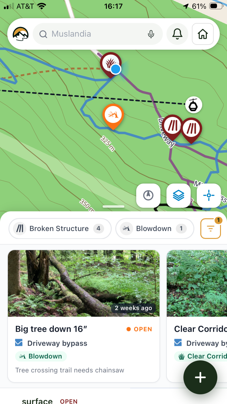
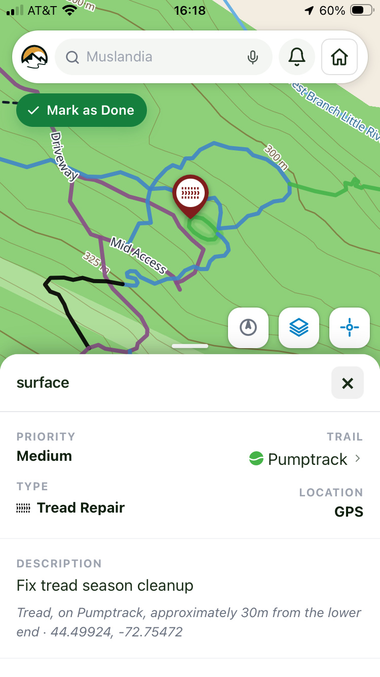
InfrastructureMap-first, built for one hand and no signal. Download a whole network before you leave and the map, the photos and the work list all come with you.
The appsWalk a line with GPS, draw it, or let the route finder propose one that holds a sustainable grade — then price the build and send a proposal a landowner can read.
Trail plannerA hiker or rider files what they found from their own phone, with the location attached. It lands in your triage queue, not an inbox.
Public reportsA block-based site builder with news, an events calendar with signups and waivers, and branded QR codes — so your public presence lives in the same place as your trails, not a separate website nobody updates.
Your public siteTime logged against the item it was spent on, expenses filed from the field with approval, and an inventory that answers how much lumber is at which trailhead and who has the chainsaw.
Crew and costsChairs, gondolas, T-bars and carpets with a daily status, and infrared or inductive counters — including TRAFx imports — so usage is measured rather than guessed.
Counters and liftsSlope shading, aspect and contour lines generated from open elevation data — the terrain read you would otherwise stitch together from three other tools.
Maps and terrainWhat was found, what was fixed, what it cost and who did it — over any stretch of time, plus the seasonal checklists that prove the walk happened.
ReportingHow the work moves
The report app — for trail visitors
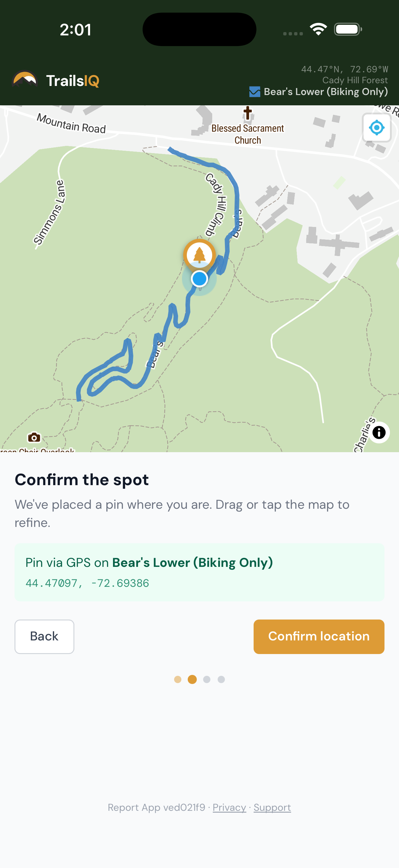
A trail user opens your report page on their phone, marks where they are, adds a photo and describes what they found. It arrives as a maintenance item on the right trail — already located, already photographed — and enters the same triage queue your own crew files into.
The field app — for trail crews
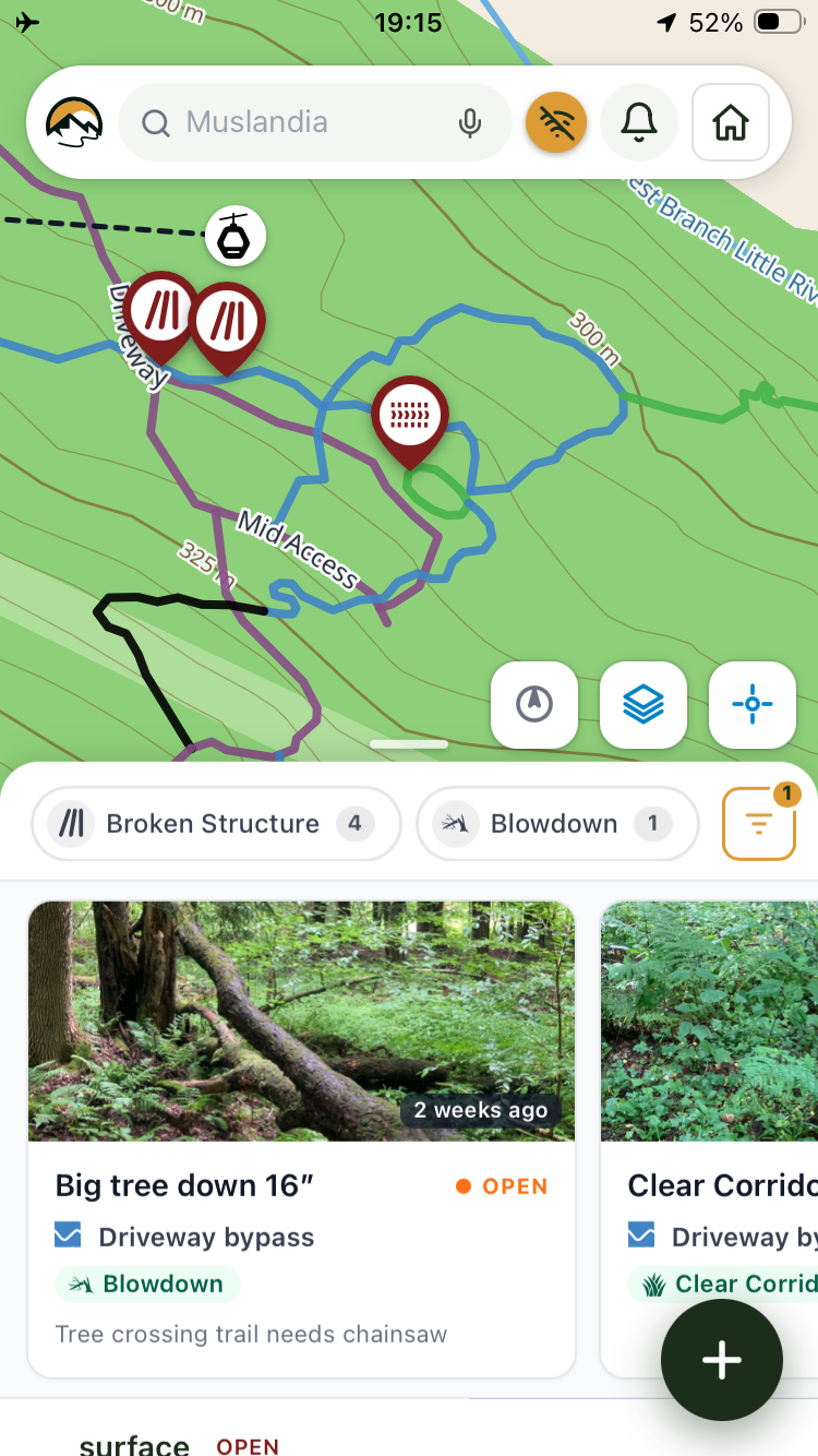
The field app is what the crew actually uses. It opens on the map, works with one thumb, and does not need signal — file an item, log the hours against it, record a new line, photograph a bridge, and everything syncs when the phone next sees a tower.


The trail planner
Walk the line and record it, draw it on the map, or give the route finder two points and a grade to hold. TrailsIQ reads the terrain underneath, flags the sections that will not last, prices the build by width and surface, and turns the result into a proposal you can send to a landowner or a council.
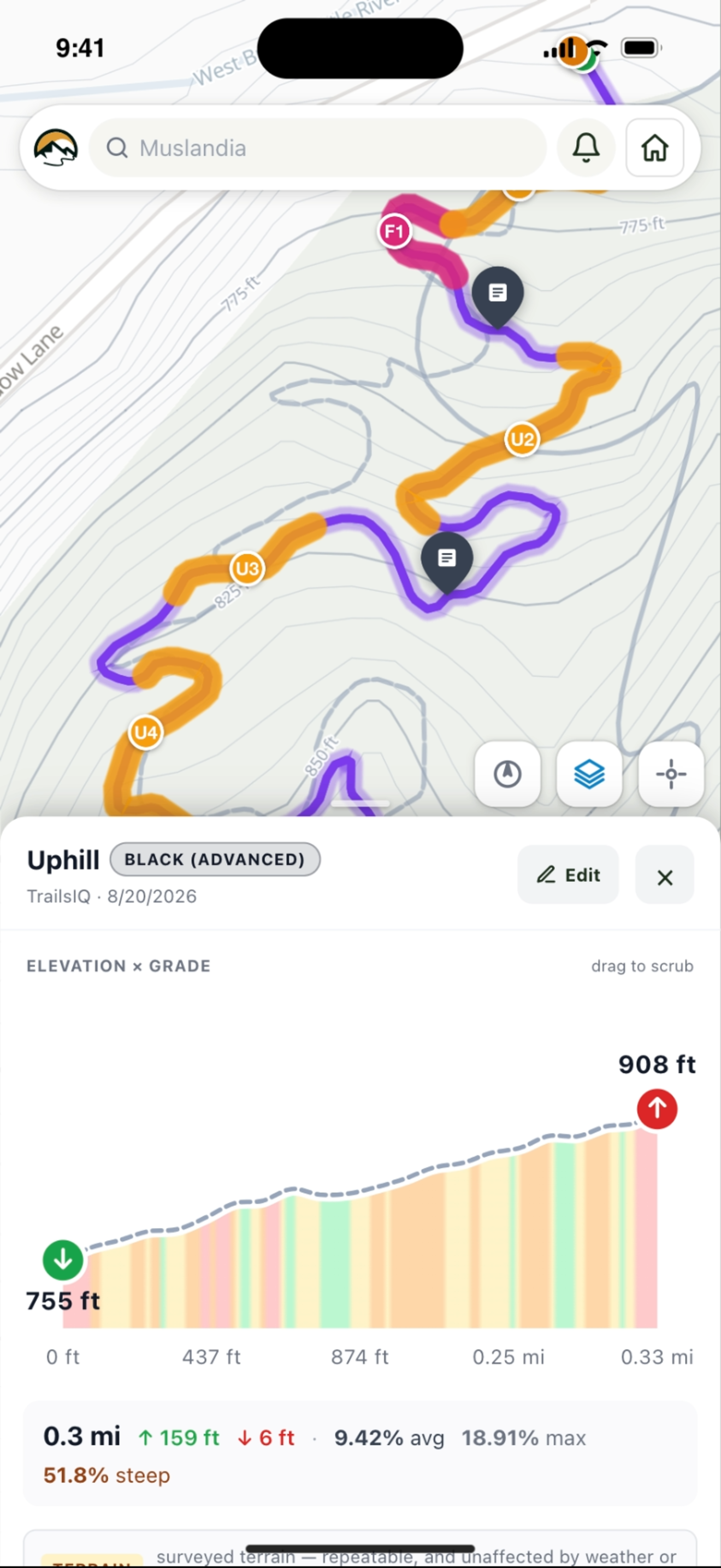
The TrailsIQ map
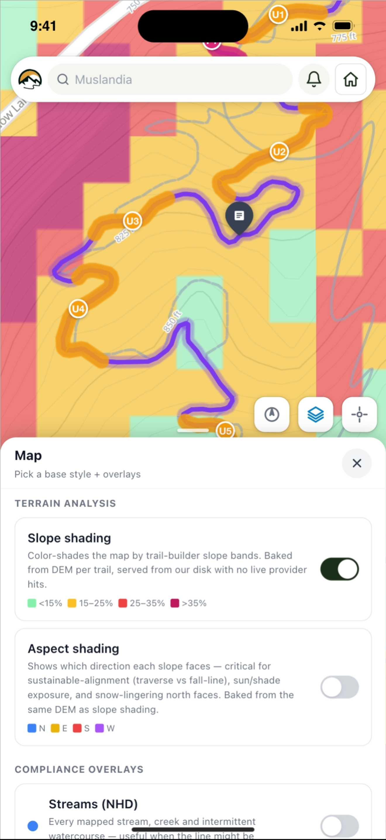
Where a trail goes is decided by the ground under it — how steep the hillside is, which way it faces, whether that flat bit is a wetland, and whose land it is. TrailsIQ draws its own base map and carries all of that on top of it, so it is a button on the map you already have open rather than eight browser tabs of state and federal viewers.
Map layers
The dashboard, a planned line, the field app in your pocket — same layers, same button. Aerial photography is there too over the lower 48, and a network you have downloaded keeps its base map and terrain on the device, so a valley with no signal is a normal working day. Contours and hillshading are on every plan; the rest come with Core and up.
Start free — 10 trails and your whole crew on the field app. Move up when the network does.