Climbing
Crags and climbing routes — topos, grades, and fixed gear
Manage climbing terrain alongside trails: crags with topo photos and drawn route lines, routes with discipline, grade system, stars and protection, multi-pitch breakdowns, and an inspection history for every bolt and anchor you are responsible for.
If your organization manages climbing as well as trails, TrailsIQ carries crags, routes, pitches and fixed gear as first-class records — with topo photos, grades, and an inspection history for every bolt and anchor you are responsible for.
Turning climbing on
Crags and Routes appear in the sidebar only when climbing is enabled for your organization. If you manage climbing terrain and do not see them, ask us to switch it on — there is nothing to configure at your end.
Trails and climbing coexist happily; enabling one does not affect the other.
Crags
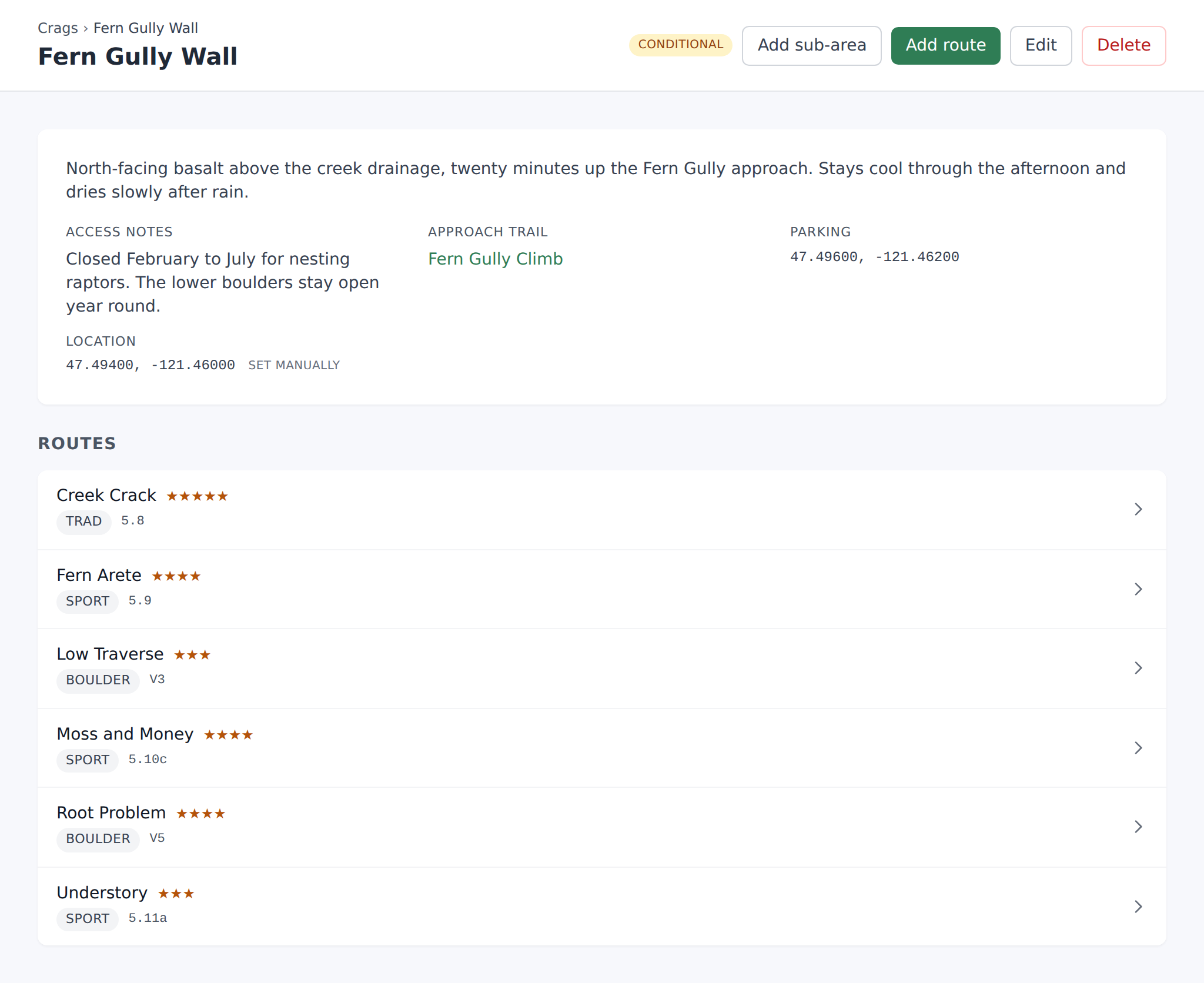
A crag is a climbing area — a cliff, a boulder field, a wall. It is the container everything else hangs off, the way a network contains trails.
Create one from Crags → New. A crag carries a name, a description, a location on the map, and one or more topo photographs.
Crags show on your maps alongside trails and infrastructure, so an approach trail and the wall it serves are visible in the same view. That matters for the everyday question of who is responsible for what: the washed-out approach is a trail maintenance item, the loose block at the base is a crag one, and they are usually reported by the same person on the same day.
Topos
A topo is a photograph of the crag with route lines drawn over it — the standard way climbing information is communicated, and far more useful than coordinates for anything vertical.
Upload a photo to a crag and draw each route's line onto it. A crag can carry several topos, which is what you want for a wall photographed from more than one angle or a long cliff split into sections; each topo keeps its own frame, so route lines stay registered to the photo they were drawn on rather than to a shared canvas.
Topos are what the Field App shows a volunteer standing at the base, and what a public page shows a visitor.
Routes
A route belongs to a crag and records what climbers need to know:
- Name and description
- Discipline — sport, trad, boulder, and so on
- Grade, together with the grade system it is quoted in, so a French sport grade and a Yosemite Decimal one are not silently confused
- Star rating — quality, the usual 0–3
- Height
- Protection summary — what to bring
- First ascent — who and when
- Status — whether the route is open, closed, or under work
- Tags and a base location
Status is the field that earns its keep operationally. A route closed for raptor nesting, loose rock, or a failed anchor is closed everywhere at once — dashboard, field app, and any public page — from one edit.
Multi-pitch routes
Mark a route as multi-pitch and it gains pitches, each with its own grade, length and description.
This is not cosmetic. Fixed gear attaches to a pitch, not just to a route, so "the second bolt on pitch 3" is a record you can inspect and replace rather than a line in a notes field. On a long route that distinction is the difference between an inspection log you can act on and one you have to interpret.
Fixed gear and inspections
Every bolt, anchor and piece of fixed hardware can be recorded against its route or pitch, with:
- Type and position on the pitch
- Manufacturer and model
- Installed date, and who installed it
- Last inspected date, and who inspected it
- Condition
- Notes
Inspecting is its own action rather than an edit, so the history builds up as a record of who checked what and when.
If you are responsible for fixed hardware, this is the part of the climbing feature that matters most. Anchors have a service life, corrosion is not always visible from the ground, and "when was that last looked at" is a question that needs an answer with a date on it — from a record, not a memory.
Climbing in the Field App
Crags and routes are available in the Field App, so they can be created and edited from the base of the wall.
The usual sequence is: photograph the wall, draw the lines, and fill in grades and protection while you are standing under them and can see what you are describing. Doing it from memory at a desk is where errors come from.
Common gotchas
- Grade without a grade system is ambiguous. "5.10" and "6a" are different scales; always set the system so nobody has to guess which one you meant.
- Fixed gear belongs to a pitch on a multi-pitch route. Attaching everything to the route works, but it costs you the ability to say which pitch a suspect bolt is on.
- Closing a route is not the same as deleting it. Use status for a seasonal or temporary closure — deleting takes the inspection history with it.
- A topo is registered to its own photo. If you replace the photograph, redraw the lines; they were drawn against the old image's frame.
- Approach problems are trail items. File a washed-out approach as a maintenance item against the trail, not as a note on the crag, so it reaches the crew that fixes trails.